Severe storms possible in Tallahassee Thursday night into Friday as cold front approaches
Tallahassee could see a few severe storms Thursday night into Friday ahead of a cold front that will ramp down the unseasonable heat and humidity in time for the weekend.
The Storm Prediction Center shows Tallahassee and much of Leon County under a slight risk (2 on a scale of 1-5) for severe storms.
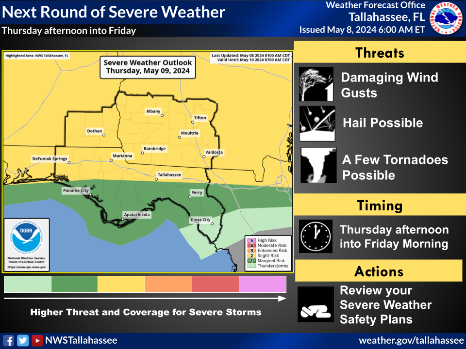
“We’re looking at potential for some damaging wind gusts, hail and possibly a few tornadoes,” said Lance Frank, meteorologist with the National Weather Service in Tallahassee.
Locally heavy rainfall is possible, along with flash flooding in low-lying and flood-prone areas.
“Some of those storms could be slow moving or they could train when we have one storm after another,” Frank said. “And that would increase the potential for possibly some flash flooding as we get into Friday.”
The cold front will sweep away the unseasonable heat and humidity seen over the past week, with highs that had been in the 90s dropping to the low 80s and lows that had been in the 70s dipping into the low 60s.
“As we get into Saturday, you’re going to notice quite a difference,” Frank said. “So very comfortable air mass coming in this weekend.”
This article originally appeared on Tallahassee Democrat: Severe storms possible in Tallahassee Thursday night into Friday

